The Porcupine Rim trail is one of the epic mountain bike rides in the Moab (Utah) region. It affords views of massive Castle Valley and features an incredible 15-mile downhill.
From Porcupine Rim (and other places around Moab: the Slickrock Trail, Arches National Park, etc.), I’ve always gazed toward the La Sal Mountain range to the southeast and wondered what it was like up there.

Holy Cow! Are we in Moab? Beyond the beef are the La Sal Mountains.
Because it’s currently still pretty hot in Moab, it seemed the right time to head up toward the 12,000-foot series of peaks (Mount Peale at 12,721 feet being the highest) and explore a bit.
What a discovery!
From a pullout overlooking Castle Valley off La Sal Loop Road, I came across the Hazard County Trail. It’s a tremendous singletrack trail — open to mountain bikes — that dips through aspen groves and offers sensational views of the La Sals, Castle Valley and all the sprawling canyons west toward Moab.
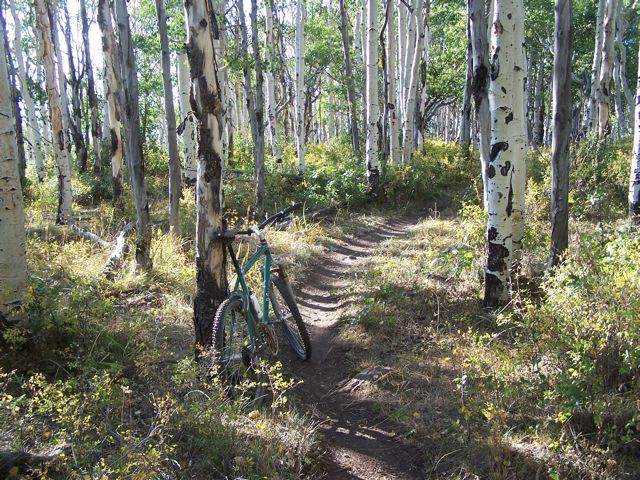
Aspens and singletrack.
When you discover a great new trail, you feel like a prospector who just struck gold. Riding along smooth singletrack through aspens has never been an experience I’ve associated with southeastern Utah.
I did the Hazard County Trail as an out-and-back and didn’t complete the entire section that runs all the way to Warner Lake. I ran into a high-elevation pasture (it felt like a scene from “The Sound of Music”) with a lot of cows and horses. Being tired and hungry, I turned back and enjoyed the four miles or so that I had just climbed. (Being in a pasture with a lot of loose big animals always freaks me out. The word “stampede” jumps to mind.)
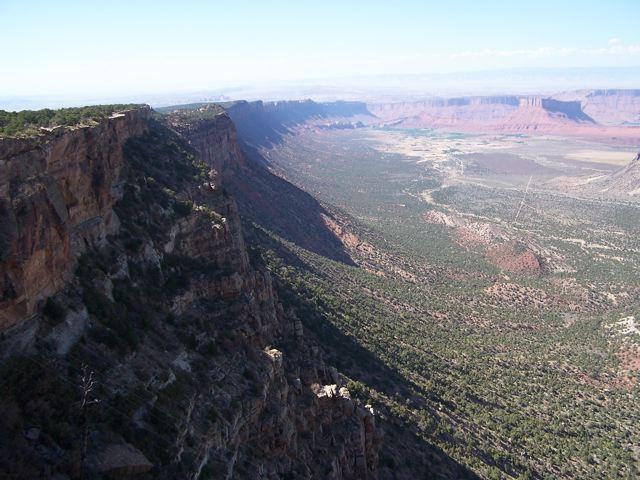
The rim of Castle Valley — one big drop.
Directly across the road from the Hazard County Trial trailhead, a section of the Kokopelli Trail drops down toward the Castle Valley Rim and eventually connects with Porcupine Rim. The Kokopelli Trail is an off-road route that leads from western Colorado (near Fruita) to Moab. It’s 140 miles of hard riding and right now is not the time to try to tackle it. Most people mountain bike it in five or six days with support vehicles.
Using a shuttle, it seems a ride from Warner Lake to the bottom of Porcupine Rim would be one amazing day of riding. You’d want to get a real early start on that one.
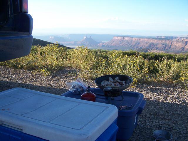
Bacon and eggs with a view. Then a bear came. Go figure.
My photos don’t do this vast landscape any justice. The mountains dropping into the surreal desert canyons is an otherworldly view. A young guy from Boston pulled his car over and checked out the expanse toward Castle Valley. He was wide-eyed when he turned to me and said, “I’ve never been out here before and this is just blowing my mind.” There was a slight apprehension to him. That’s understandable. You don’t find anything like this in Massachusetts.
Not long after he departed, I spotted a black bear crossing the road. Hmm, I wonder if he smelled the bacon and eggs I was cooking? I also spotted a half dozen deer and heard a primal chorus of coyotes.
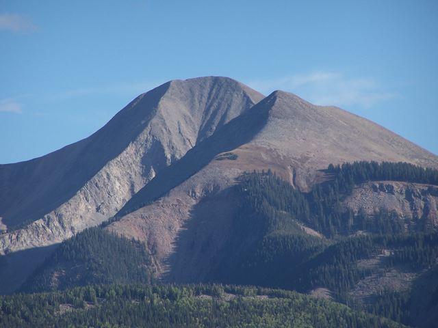
Mount Beale (left) and Mount Tukuhnikivatz. These gals are typically dressed in white coats.
It’s important to note that there are more search-and-rescue calls in Moab’s Grand County than any other county in Utah. When you’re miles out in the desert and something goes wrong, you can easily become a future bone pile. It’s so dry and hot (it takes gallons of water a day to survive), and if you become disoriented, everything looks the same.
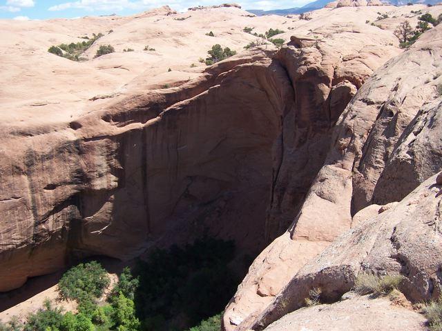
Negro Bill Canyon from the Slickrock Trail. Not a place to have a brake failure.
Earlier in the day, I cooked myself on a section of the Slickrock Trail and I discovered just how out-of-shape I am. It’s Moab’s most famous trail and I’ve done it several times, but I was struck by how technical it is. You really need to have your bike dialed in (check your brakes!) and riding skills dialed in. Crashing on solid rock with dropoffs everywhere is not advisable.
••••••••••••••••••••••••
I’m in the Moab library right now using free wi-fi and aren’t libraries the greatest thing? It’s making me miss my other office in Redding — the Shasta County Library.
You use all this electricity — I have my iPod, camera, phone and laptop charging — and no one kicks you out. You don’t even have to purchase a latte.
••••••••••••••••••••••••
I don’t know where I’m going next, but it’s between Natural Bridges National Monument, Durango or Telluride. I’m leaning toward my old hometown (Durango), but who knows? It’s one of those kinds of trips. No itinerary and moving around on instinct.