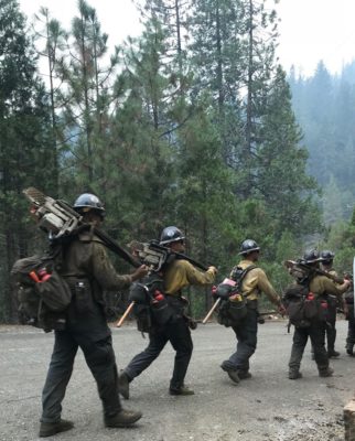
Photo from U.S. Forest Service – Shasta-Trinity National Forest
Update from U.S. Forest Service – Shasta Trinity National Forest
Yesterday, control lines held on the west and north edges of the fire, where crews began mopping up, or extinguishing remaining burning material near the control line. Fire activity within control lines on the east side of Interstate 5, between Sims Road and Gibson Road, resulted in a temporary closure of Interstate 5 due its proximity to the fire. Numerous helicopter water drops successfully extinguished the approximately 20-acre area. Interstate 5 re-opened to through traffic shortly afterwards.
Today, firefighters will continue to construct fireline directly on the fire’s edge between Hazel Creek and Sims Flat area on the east side of Interstate 5. Travelers on the highway are likely to see smoke and/or firefighting operations between Gibson Road and Sims Road exits.
PDF Map: https://inciweb.nwcg.gov/incident/map/6191/0/88551
More information: https://inciweb.nwcg.gov/incident/6191/
Smoke Outlook: https://tools.airfire.org/outlooks/Shasta-TrinityArea
Update from CalTrans
Interstate 5 is now open in both directions with limited control.
Ramp closures will remain in effect at Sims Road and Gibson Road due to evacuation orders that are still in effect. Rest areas at O’Brien and Lakehead are now open. Due to re-construction of damaged freeway infrastructure, travelers may be subject to single lane traffic control during daytime hours between Lamoine and Pollard Flat. Motorists are asked to drive with caution and to be aware that emergency vehicles may be in the area. Some of the road systems off of Interstate 5 will remain closed due to suppression efforts. Traffic Control Points will be set at the following areas: Dog Creek/Vollmers off-ramps, both north and south; Pollard Flat off-ramps, both north and south; Gibson Rd off-ramps, both north and south; and the Sims Rd off-ramps, both north and south.
For information about the Delta or Hirz Fires, call (530) 498-0953 between the hours of 8 a.m. and 8 p.m.; email deltafireshf@gmail.com; or online at https://inciweb.nwcg.gov/incident/6191.
Update from nwcg.gov
Yesterday, federal, state, and local government firefighters achieved 28 percent containment by continuing aggressive fire suppression efforts on the Delta Fire. Control lines held on the west and north edges of the fire, where crews began mopping up, or extinguishing remaining burning material near the control line.
On the northeast edge, crews completed a significant portion of hand and dozer line around the Slate Creek and Shotgun areas. Fire activity within control lines on the east side of Interstate 5, between Sims Road and Gibson Road, resulted in a temporary closure of Interstate 5 due its proximity to the fire. Numerous helicopter water drops successfully extinguished the approximately 20-acre area. Interstate 5 re-opened to through traffic shortly afterwards.
Crews successfully completed dozer line on the northeastern edge of the fire. The containment line connects the western edge of the Hirz Fire near North Salt Creek Road into Hazel Creek. In the southern area of the fire, firefighters focused on building direct fireline using the Sanford Road system below Damnation Peak.
Today, firefighters will continue to construct fireline directly on the fire’s edge between Hazel Creek and Sims Flat area on the east side of Interstate 5. Travelers on the highway are likely to see smoke and/or firefighting operations between Gibson Road and Sims Road exits. Line construction will also continue near Damnation Peak along Sanford Road to tie in the southern edge of the fire. Crews will continue to monitor a small area of activity that occurred overnight on the southeastern edge of the fire near Rabbit Flat.
Weather conditions are favorable for continuing operations along the west and north edges of the fire, where firefighters will continue mop-up operations to strengthen existing control lines. Fifteen helicopters will continue air operations throughout the fire area as conditions allow.
| Total Personnel | 3,264 |
| Size | 60,018 Acres |
| Percent of Perimeter Contained | 28% |
| Estimated Containment Date | Saturday September 22nd, 2018 approx. 12:00 AM |
| Fuels Involved | Timber (Litter and Understory)
Brush (2 feet) Mixed conifer of varying ages, decadent brush with no recent fire history, and a heavy dead and down surface fuels component. |
| Significant Events | Moderate
Flanking Backing Spotting Fine fuels have recovered from the higher humidity of previous days. Spotting from rollout and torching will be more likely today. Fire has few remaining slopes to run. Fire is checked on containment lines and topographical features. |
Road Closures/Openings:
Interstate 5 is open with limited traffic control between Redding and Mt. Shasta. All truck load restrictions have been lifted. Ramp closures will remain in effect at Sims Road and Gibson Road due to evacuation orders that are still in effect. Rest areas at O’Brien and Lakehead are now open. Due to re-construction of damaged freeway infrastructure, travelers may be subject to single lane traffic control during daytime hours between Lamoine and Pollard Flat. Motorists are asked to drive with caution and to be aware that emergency vehicles are still in the area. Some of the road systems off of Interstate 5 will remain closed due to suppression efforts. Traffic Control Points will be set at the following areas: Dog Creek/Vollmers off-ramps, both north and south; Pollard Flat off-ramps, both north and south; Gibson Rd off-ramps, both north and south; and the Sims Rd off-ramps, both north and south.
Forest Area Closures:
To provide for public safety during the suppression of the Delta Fire, Shasta-Trinity National Forest lands, roads, and trails around the fire perimeter have been closed under order number 14-18-18. For specific recreation information, please call the Shasta Lake Ranger District at (530) 275-1587 or the Mt. Shasta Ranger Station at (530) 926-4511.
Shasta County Evacuations:
The Shasta County Sheriff’s Office has issued mandatory evacuations for residents along the Interstate 5 corridor from exit 707 at Vollmers north to exit 714 at Gibson. Follow the Shasta County Sheriff’s Facebook page: www.facebook.com/Shasta-County-Sheriffs-Office-1527637610823075/
Siskiyou County Evacuations:
The Siskiyou County Sheriff’s Office has issued an evacuation warning, not a mandatory evacuation, for all residents of Dunsmuir. Follow the Siskiyou County Sheriff’s Office Facebook page: www.facebook.com/SiskiyouCountySheriff.
Trinity County Evacuations:
The Trinity County Sheriff’s Office has issued a mandatory evacuation notice for residents of East Fork Road to Ramshorn Road east to the Shasta Trinity County line. There will be a hard road closure at East Side Road and East Fork Road for nonresidents. There is an evacuation advisory only from the East Fork/East Side Road junction west to Highway 3 northward to Ramshorn Road. Follow the Trinity County Sheriff’s Office Facebook page: https://www.facebook.com/Trinity-County-Sheriffs-Office-1635934306689276/
Evacuation Shelters:
An evacuation shelter is located at the National Guard Armory at 618 Everitt Memorial Hwy in Mount Shasta, California. The Redding Shelter is on standby located at 100 Mercy Oaks Drive in Redding, California.
Small Animal Shelter:
The Siskiyou Humane Society is housing dogs and cats for evacuees using the evacuation shelter. The humane society is at 1208 North Mount Shasta Blvd (530-926-4052). Evacuees can bring their pets and visit/feed/feed them during the shelter hours of operation (9 a.m. to 4 p.m.). Evacuees are responsible for taking care of their own animals every day.