There’s a new ranger in town up on the Modoc National Forest—at least temporarily. She is Danelle Harrison, acting forest supervisor—on loan from the Kaibab National Forest down near the Grand Canyon—which she promotes proudly with a Kaibab National Forest belt buckle accessorizing her forest service uniform. She also wears a smile as cheerful as the yellow Shasta daisies now blooming in the California Outback.
In the few months Harrison has been in charge, she’s seen bits and pieces of the 1.68-million-acre national forest. Arriving in a very wet year after a prolonged drought and life in the Arizona desert, her “wow” factor has been all the water—wetlands, vernal pools, lakes and full-up reservoirs dotting the high desert. She is especially looking forward to Blue Lake, a spot that is “one of the most popular places on the forest” and one of several alpine lakes in the Warner Mountains where visitors can drink up pretty views and solitude.
On this day, she’s is traveling with West Zone District Ranger Chris Christofferson (yes, he sings, he says, but only on Sundays) for a tour on the Modoc Plateau to view how the forest service is trying to restore the forest floor to conditions before European settlers arrived and mucked up the ecology. At the wheel of her new white Ford SUV is Public Affairs Officer Ken Sandusky, who takes a bit of ribbing for making sure he doesn’t mess up the boss’s new rig that skitters over occasional bumps in the gravel road.

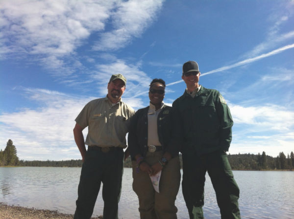
Duncan Reservoir, where Modoc National Forest’s Ken Sandusky, left, Danelle Harrison and Chris Christofferson started the tour, is a free campground and boating is permitted. Photos by H.A. Silliman.
Modoc National Forest is a patchwork of sage steppes and pine forest biomes—with the forest ecology starting at about the 5,000-foot elevation. Along the bottom edge of the forest grow juniper trees—pungently fragrant, with those little blue-green berries that create the tangy taste of vermouth. But this same tree is considered an intruder—unwanted because as it marches down from the mountains onto the steppes, it pushes out various kinds of plant and animal species. A single juniper can suck up hundreds of gallons of water a day, drying out the ground beneath and around and poisoning the dirt so little can grow under its canopy. It’s an alien that needs whacking.
And whacking is what governmental agencies along with private parties are now doing over large tracts of land. The Modoc National Forest Service has become so accomplished at juniper removal that its work has won wide acclaim. The biggest prize, though, from all the cutting has been restoring the habitat of the sage grouse—a plump little bird that is unique to the region. Junipers are, in fact, an accomplice to fowlicide as they provide convenient perches for raptors who can swoop down and munch on the little creature.
Of course, not all junipers are bad: “Historically, some have been on the landscape,” Christofferson notes.
The back country on this day in mid-June is still green out on the steppes; wildflowers and pools of water decorate the landscape; through a pocket of trees and grazing in a distant meadow are a half dozen wild horses—themselves a nuisance of sorts for prolific breeding and over-grazing. The tour also moves through periodic herds of cattle and came upon hundreds of sheep, with their overlapping chorus of bah-bahs as they happily munch away—and parked nearby is a modern shepherd’s wagon, with rubber tires instead of wooden spoke wheels.
Part of Ranger Christofferson’s job is to oversee the projects to reduce the junipers and also open up the forest floor by highly planned removal of underbrush and small trees—along with selected timber harvesting. Up on the plateau that is north of Canby on the way to Klamath Falls, as the tour goes along, he points out the great swaths of land where junipers have been removed and stands of conifers where the underbrush has been thinned.
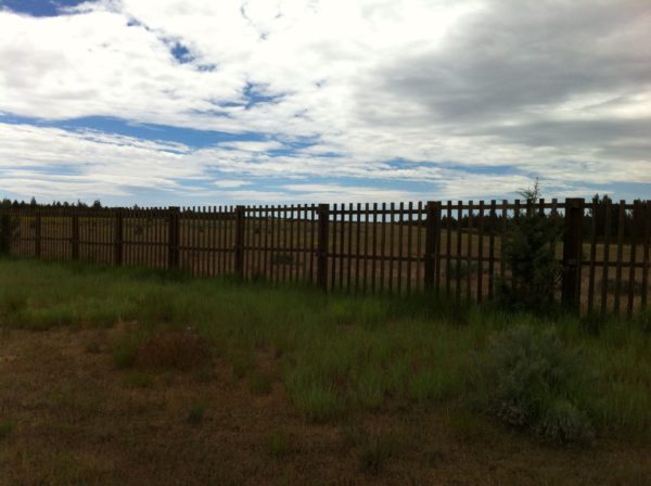
Later, the tour makes a right turn and begins following a rather well-groomed gravel road where posts marking underground utilities are suddenly seen—a definite anomaly—as if this were a pathway to a land subdivision. But after a few minutes instead of homes appearing, a tall, latticed wooden fence looms up—looking like a safari compound: You wonder, where are the giraffes?
Harrison and company have arrived at one of three locations of a shuttered Air Force “back-scatter” radar site. There are three of these 300-acre installations up in the California Outback. Explains Christofferson and Sandusky: They were constructed but never used, as by the time they were finished, the Air Force turned to satellite systems to track potential incoming bad guys. Now, the abandoned sites must be cleared of the buildings and equipment and returned to the Forest Service—sans fence, which has been treated with arsenic and must be removed and the surrounding soil cleaned.

Not a game compound, this fence in the middle of nowhere surrounds a shuttered Air Force radar site on Modoc National Forest.
Considering the sheep that graze, the cattle that graze, the conifers harvested for wood, obsidian that can be collected—and rocks, too, plus the recreation on the forest—remote campgrounds that edge reservoirs—Modoc National Forest truly is a “land of many uses” just as the brown and yellow “Entering-Leaving” signs proclaim. So seeing a radar station—albeit decommissioned—in the middle of the high country is more ironic than alarming—especially when down the road a piece from Clear Lake, Sandusky points out a ridge of rocks where he and his wife (both have Native American blood) held their “joining” ceremony for marriage—a sacred place to the Pit River Tribe where The Creator might have easily dropped in from overhead.
And places on the forest around Clear Lake and the neighboring Medicine Lake Highlands are similar in importance, in the same way as the historic cathedrals of the Europeans, says Christofferson, making the historical comparison. It’s an area of “special cultural” significance—a gathering site for the tribes. In lore, the highlands are where the Creator rested and in the clear, cold waters of Medicine Lake, rejuvenated.
The last big stop of the day is rejuvenating, itself, and a bit of a “high”: The Blue Mountain fire lookout station, elevation 5,740 feet, manned today by Gary Neal, a 13-year fire lookout veteran. The steel tower is topped by a little hut that contains a kitchenette, a bed, and the round “azimuth” map with cross-hairs that can help pinpoint fires before they get out of control. Visitors—who aren’t averse to heights—can climb the shallow metal steps and as a reward can sign the guest book registry.

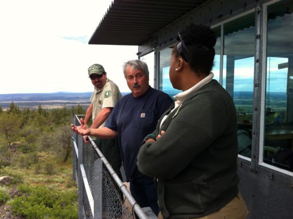
Blue Mountain Lookout worker Gary Neal, center, describes the lay of the land to Gary Sandusky, left, and Danelle Harrison.
From the outside catwalk, Neal points out for Harrison and visitors landmarks on the far horizon—Burney Mountain, a bit of Lassen Peak, and other forest look-out towers, and explains that 99 percent of forest fires are started by lightning strike: Hundreds of strikes can occur during a summer thunderstorm. This brings to mind the image of Smoky the Bear and his message, “Only you can prevent forest fires”—a testament to the awesome responsibility belonging to forest service lookouts who work the towers dotting the horizon.
As the tour winds down and the SUV zips along, passing from sage steppe to juniper forest into conifer forest and back out again—and passing through territory “treated” with juniper removal, the difference between land clogged by junipers and places where they have been cleared is amazingly dramatic: With the trees gone, with the landscape reverting back to its scruffy, sage steppe origins, the great dome of the deep blue sky becomes breathtakingly visible. It’s like you’re sailing on the ocean with the horizon faraway—and you realize why pioneer wagons were called prairie schooners.
Says the cheerful Harrison about the expansive sky: “Being on landscape like this…this is the place where I want to be.” It’s no wonder, then, why Native Americans called this part of the world, “Smiles of the Gods.”
© 2017 H.A. SILLIMAN ALL RIGHTS RESERVED

