

CALFIRE UPDATE 7:00 pm
Size: 172,055 acres Containment: 47% Expected Full Containment: Unknown Firefighter Injuries/Fatalities: 2
STRUCTURAL SUMMARY
Structures Threatened: 937
Residential Structures Destroyed: 1,077 Commercial Structures Destroyed: 22 Other Destroyed: 500
Residential Structures Damaged: 191 Commercial Structures Damaged: 26 Other Damaged: 65
CURRENT SITUATION
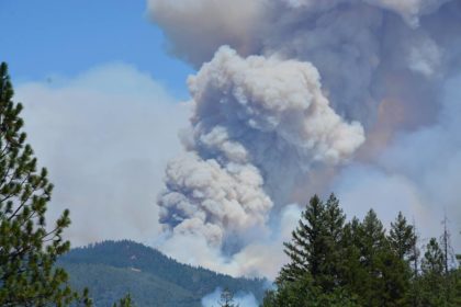
Situation Summary: Smoke over the fire area has tempered fire activity today. Heavy timber fuels are still challenging firefighting efforts. Firefighters will work through the night constructing containment lines and mitigating spot fires across control lines. Repopulation of residents affected by evacuations will continue as conditions permit
Evacuations: Shasta County:
Community of French Gulch
Swasey Drive North from Lower Springs Rd to Hwy 299
Whiskeytown Park
Placer Rd at Platina Road, South Fork Rd, Zogg Mine Road, Jenny Bird Lane, Horse Canyon Rd and all residents West of Platina Rd between Placer Rd and Buell Rd
All areas on South Fork Road from Zogg Mine Rd to South Fork Road to include the areas of Bender Rd, Serenity Dr & Serenity Way
Trinity County:
Trinity/Shasta County Line at Buckhorn Summit Rd W. to Trinity Dam Rd. All roads w/in this area North of Hwy 299
Deadwood Road East of Trinity Dam Blvd
Lewiston Turn Pike East of Trinity Dam Blvd
Trinity Dam at Trinity Dam Blvd
Road Closures: Shasta County:
JFK Memorial Road At Hwy 299
Victoria Drive at Hwy 299
Gas Point Road at Clear Creek Rd
Platina Road at Bully Choop
Iron Mountain at Rock Creek Road
Hwy 299 at Buenaventura Blvd
Iron Mountain Road at Hwy 299
Swasey Drive & Lower Springs Road
Hwy 299 at Ridge Road
Muletown Road at Red Bluff Road
South Fork road at Zogg Mine Road
Trinity County:
Hwy 299 East of Trinity Dam Blvd
Lewiston Turnpike East of Trinity Dam Blvd
Trinity Dam at Trinity Dam Blvd
East Side Road at East Fork Road
Deadwood Road East of Trinity Dam Blvd
……………………………………………………
CARR FIRE REPOPULATION
WHAT: Repopulation of the Community of Igo except for South Fork Road and
Zogg Mine Road. Muletown Road North of Placer will be open.
WHEN: August 7, 2018 at 6:00 P.M.
WHERE: Evacuations orders have been lifted and residents may return home in the
following areas.
Repopulation into the Community of Igo. A road closure will be in place at
Placer Road and South Fork Road. No access will be permitted from this
closure point onto South Fork Road or Zogg Mine Road. A road closure
will be in effect at Placer Road and Platina Road and no access
westbound on Platina Road will be permitted. All of Placer road will be
open into the Community of Igo.
Road Closures:
Placer Road at South Fork Road
Placer Road at Platina Road
Some residents may only have limited access to their properties due to
safety concerns.
: August 7, 2018
6:00 PM
CARR FIRE REPOPULATION
WHAT: Repopulation of The Community of Lewiston.
WHEN: August 7, 2018 at 6:00 p.m.
WHERE: Evacuation orders have been lifted and residents may return home in the
following areas.
Lewiston area west of Clark Creek Road to Poker Bar Road.
North of Hwy 299 to Hatchery Road to include Dead Mule Gulch Road,
Twin Oaks Road, Carr Pl, Bear Creek Trail, Gibson Road, Henrietta Road,
Riley Mine Road and Fish Hatchery Road.
Lewiston area West of Trinity Dam Boulevard to Poker Bar Road.
North of Hwy 299 to Fallen Bridge Road to include Trinity Dam Boulevard,
Mountain View Drive, Texas Street, Old Lewiston Road, Lewiston Turn
Pike, Deadwood Road, Fawn Lodge Road, Wellock Road, Browns
Mountain Road, Union Ridge Road and all other roads within the Lewiston
Area.
**Lewiston Turn Pike East of Trinity Dam Blvd and Deadwood Road
East of Trinity Dam Blvd. will remain under mandatory evacuation. **
Road Closures
Hwy 299 will be closed just East of Trinity Dam Boulevard.
Lewiston Turnpike will be closed east of Trinity Dam Boulevard.
Deadwood Road will be closed east of Trinity Dam Boulevard.
Trinity Dam at Trinity Dam Boulevard will remain closed.
East Side Road will be closed at East Fork Road.
August 7, 2018
5:30 P.M.
CARR FIRE REPOPULATION
WHAT: Repopulation and Re-entry of Swasey Drive North from Lower Springs
Road to Hwy 299.
WHEN: August 7, 2018 at 5:30 P.M.
WHERE: Evacuations orders have been lifted and residents may return home in the
following areas.
All Residents on the West and East sides of Swasey Drive from Lower
Springs Road to Hwy 299. **Residents Only**
Re-entry to all residents on the West and East sides of Swasey Drive from
Lower Springs Road to Hwy 299. Access to this area will be via Placer
Road to Swasey Drive. Red Bluff road will remain closed at Swasey
Drive. Residents entering this area will be required to provide
documentation of residency. Some residences may be without power
and/or other utilities.
Road Closures
Swasey Drive at Lower Springs Road *Residents Only*
Swasey Drive at Red Bluff Road
Swasey Drive at Hwy 299
Some residents may only have limited access to their properties due to
safety concerns.
…………………………………………….
RELEASE DATE: August 7, 2018
12:00 PM
CARR FIRE REPOPULATION
WHAT: Repopulation and Re-entry of the Old Shasta Community.
WHEN: August 7, 2018 at 12:00 p.m.
WHERE: Evacuations orders have been lifted and residents may return home in the
following areas.
All Residents in Old Shasta on the North and South Side of SR-299.
Muletown Road is not included and will remain closed at Red Bluff Road.
**Residents Only**
Re-entry to Old Shasta Community on the South and North side of SR299.
Entry access will be via SR-299 at Buenaventura Blvd and Rock
Creek Road at Granite Road. Residents entering this area will be required
to provide documentation to verify residency. Road closures will be in
effect at Swasey Drive at Red Bluff Road, Victoria Drive at SR-299 and
SR-299 at JFK Memorial Drive.
Road Closures:
SR-299 at Buenaventura Blvd **Residents Only**
Rock Creek Road at Granite Road **Residents Only**
Swasey Drive at Red Bluff Road
Muletown Road at Red Bluff Road
Victoria Drive at SR-299
SR-299 at JFK Memorial Drive
Residents are reminded to remain cautious while driving through the
closure area as utility and restoration work is still in the process of
being completed. Some residents may only have limited access to
their properties due to safety concerns.
…………………………………………………………….
CAL FIRE UPDATES 7:00 am
Size: 167,113 acres Containment: 47% Expected Full Containment: Unknown Firefighter Injuries/Fatalities: 2
STRUCTURAL SUMMARY
Structures Threatened: 1,806
Residential Structures Destroyed: 1,077 Commercial Structures Destroyed: 22 Other Destroyed: 500
Residential Structures Damaged: 191 Commercial Structures Damaged: 26 Other Damaged: 65
Situation Summary:
The fire is located in steep drainages with varying wind exposure which is challenging firefighting efforts. Firefighters will continue constructing containment lines and mitigating spot fires across control lines. Repopulation of residents affected by evacuations will continue as conditions permit.
Evacuations: Shasta County:
Community of French Gulch
Placer Road West From Diggins Rd
Swasey Drive North from Lower Springs Rd to Hwy 299
WhiskeyTown Park
The Igo Community
Keswick Community West of Keswick Dam
Cloverdale Rd from Placer Rd to Clear Creek Rd
Placer Rd at Platina Rd to Buell Rd which includes South Fork Rd, Zogg Mine Road, Jenny Bird Lane, Horse Canyon Rd and all residents West of Platina Rd between Placer Rd and Buell Rd
All areas on South Fork Road from Zogg Mine Rd to South Fork Road to include the areas of Bender Rd, Serenity Dr & Serenity Way
Trinity County:
Trinity/Shasta County Line at Buckhorn Summit Rd W. to Trinity Dam Rd. All roads w/in this area North of Hwy 299
Hwy 299 at Trinity Dam Blvd continuing North to Hwy 3 including Deadwood Road, Jennings Gulch Road, Eastman Gulch Road & Lewiston Turn Pike Road. This is to include all residences and side streets
east of Trinity Dam Blvd within the Township of Lewiston
Hwy 299 at Trinity Dam Road West to Poker Bar Rd
Trinity Dam Rd Blvd to South of the Trinity Dam including all residences within Lewiston area to Trail Drive, Red Lane, Old Highway, Lewiston Rd, Ohio Lane, Lowden Way, Ponderosa Pines, River Front Rd, Wellock Rd, S. Ponderosa Pine, Coffin Road, Dirt Rd, Benvenuto Way, Browns Mountain Rd, Mountain
Springs Rd, Jobe Way, Steelhead Circle, Rebel Rd, Quail Point Rd, Lockhart Ranch Rd, Prut Rd, Upper Salt Flat Rd, Salt Flat Rd, Goose Ranch Rd, Dredger Lane, Bacham Lane, Partridge Lane, Shady Lane, River Rock Rd, Old Oak Rd, Gulch Rd & Lewiston Turn Pike Rd
All roads & streets West of Trinity Dam Blvd & East of Lewiston Rd
Deadwood Road East of Trinity Dam Blvd
All residences on Baker Rd including Cooper Gulch, Posey Rd, Lakeview Terrace & Pine Cove Marina including Eagle Mountain Rd
For the most up to date orders visit: https://www.co.shasta.ca.us/index/sheriff_index.aspx
RESOURCES
Carr Fire Repopulation Map:
https://tinyurl.com/carrfirerepopulationmap
View live structure maps at:
www.tinyurl.com/carrfirestructuremap
Shasta County Environmental Health Division:
https://tinyurl.com/shastaehd
ASSISTANCE CENTER
Shasta High School
2500 Eureka Way
Redding, CA 96003
Evacuation Center(s):
Shasta College 11555 Old Oregon Trail Redding, CA 96003
Trinity High School 321 Victory Lane Weaverville, CA 96093
Road Closures: Shasta County:
Rockcreek Road at Hwy 299
Hwy 299 from Buenaventura Blvd to Buckhorn
Granite Drive at Mavrick Drive
Gas Point Road at Clear Creek Rd
Hwy 299 at Lower Springs Rd
Platina Road at Bully Choop
Keswick Dam Road just East of the Keswick Dam
9000 Block of Skywalker Drive
Miners Gulch at Rock Creek Road
Middle Creek Road at Iron Mountain
Keswick Dam Blvd just West of Nash Road
Iron Mountain at Rock Creek Road
Hwy 299 at Buenaventura Blvd
Iron Mountain Road at Hwy 299
Hwy 299 at Lower Springs Road
Swasey Drive & Lower Springs Road
Placer Road at Diggins Road
Hwy 299 at Ridge Road
Trinity County:
Old Hwy at Poker Bar Road
Hwy 299 at Poker Bar Road (Poker Bar Road is Open)
Rush Creek Road East of China Grade
Trinity Dam Blvd at Fairview Marina Drive
Browns Mountain Road at Lewiston Road
Animal Evac. Center(s):
Small Animal – Haven Humane 1816 CA 273 Anderson, CA 96007 (530) 241-2650
ASSIGNED RESOURCES
Engines: 388 Water Tenders: 115 Helicopters: 16 Hand Crews: 77 Dozers: 120
Other: Total Personnel: 4,738
Air Tankers: Firefighting air tankers from throughout the State are flying fire suppression missions as conditions allow.
Cooperating Agencies: Additional Cooperating and Assisting Organizations Not Listed Above:
PG&E, CAL TRANS, Shasta County Sheriff, CHP, Redding Police Department,Shasta County Fire Department, Shasta County Public
Works, CAL OES, Bureau of Land Management, CCC, State Parks, CDCR, Red Cross, Redding Electric, WAPA, California National
Guard, Trinity OES, Trinity County Sheriff’s Office, Sierra Pacific Industries, AT&T
Open: 9:00 a.m to 7:00 p.m.
August 2, 2018 to August 8, 2018


