Photographs rekindle memories.
With one of my photo albums, I can transport myself back to a cool November hiking trip around Lake Oroville.
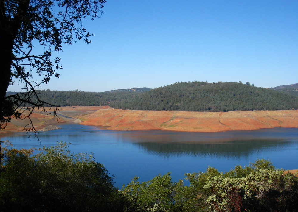
Richard and I got up early on a Sunday to hike around the lake and the Oroville Dam. We climbed to the top of a 47-foot viewing tower before hitting the trails.
Two high-powered telescopes distracted us from the biting wind and gave us a close-up view of faraway trees, birds, houses built onto the hillside, and the lake itself. We spotted a man walking across the dam and admired Table Mountain in the distance.
Richard had never seen the Oroville Dam and I hadn’t seen it in years. The dam is an important piece of local history, and it provides a spectacular view of the blue lake below. The dam’s crest is also a popular place for locals to go walking, jogging or bike riding.
The Lake Oroville Visitors Center was undergoing a remodel but, luckily for us, it was still open. Inside the museum we viewed exhibits on local topics: Lake Oroville; the Feather River; the building of the Oroville Dam; flood control; water conservation efforts in California; the Maidu; and Ishi, the last member of the Native American tribe known as the Yahi.
An old TV set up inside a mock train engine showed a video on the construction of the Oroville Dam (1963-1968), and the dedication by Ronald Reagan, who was governor of California at the time. The video was informative, but the TV screen was a bit snowy.
Outside the visitors center, we encountered the quick-and-easy Chaparral Trail. During the hike we viewed the native plants and took pictures of the forest of Manzanita trees. The burgundy bark called out for a painting. Birds chirped in the brush reminding us that we were visitors in their home.
Next we headed to the Oroville Dam. It was about a two-mile hike each way, with a moderate difficulty level and a few switchbacks. Most of the trail was shaded by Manzanitas, Toyons – red berries weighed down the branches – and pine trees.
When we reached the dam I was struck by its enormity. Oroville Dam is the tallest and one of the largest earthen dams in the country. Plaques along the top describe its size -770 feet high with a crest length of 6,920 feet. Other plaques honor the engineers as well as the 34 men who lost their lives during the dam’s construction.
Below the dam, the blue lake looked inviting. We could see boaters on the water and fishermen on the shore. On the other side of the dam, Richard pointed out three deer walking through the dry grass. We watched them, and they watched us. I was glad we’d brought a pair of binoculars and a camera. We captured the deer for a moment in time, but left them free to live out their lives.
Photographs keep memories fresh, but it’s the people, the places and the experiences themselves that give those memories meaning.
Before you go, make a dam plan:
The Lake Oroville Visitors Center is at 917 Kelly Ridge Road in Oroville. It’s open at 9 a.m.-5 p.m. daily. Admission is free. For more information, call the museum at (530) 538-2219 or visit http://www.parks.ca.gov/?page_id=462.
Check out my photos of Lake Oroville, its surrounding hiking trails, Oroville Dam, and the museum inside the Lake Oroville Visitors Center.

Journalist Lauren Brooks lives in Chico. She is the editor of the Chico Enterprise-Record’s weekly entertainment guide, The Buzz. She is a CSU, Chico alumna who graduated with a B.A. in journalism in spring 2006. She can be reached at lmbrooks.work@gmail.com.